
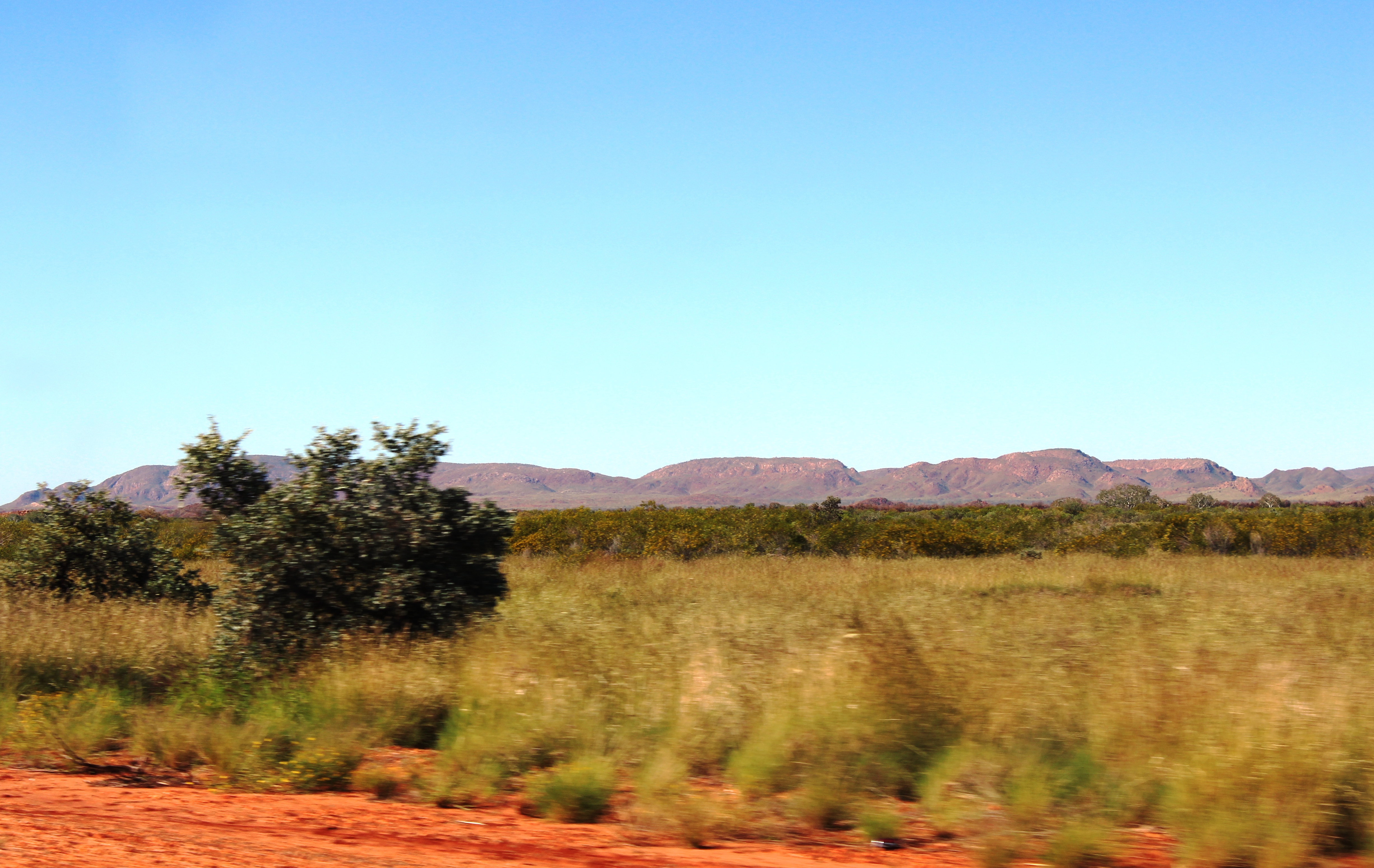
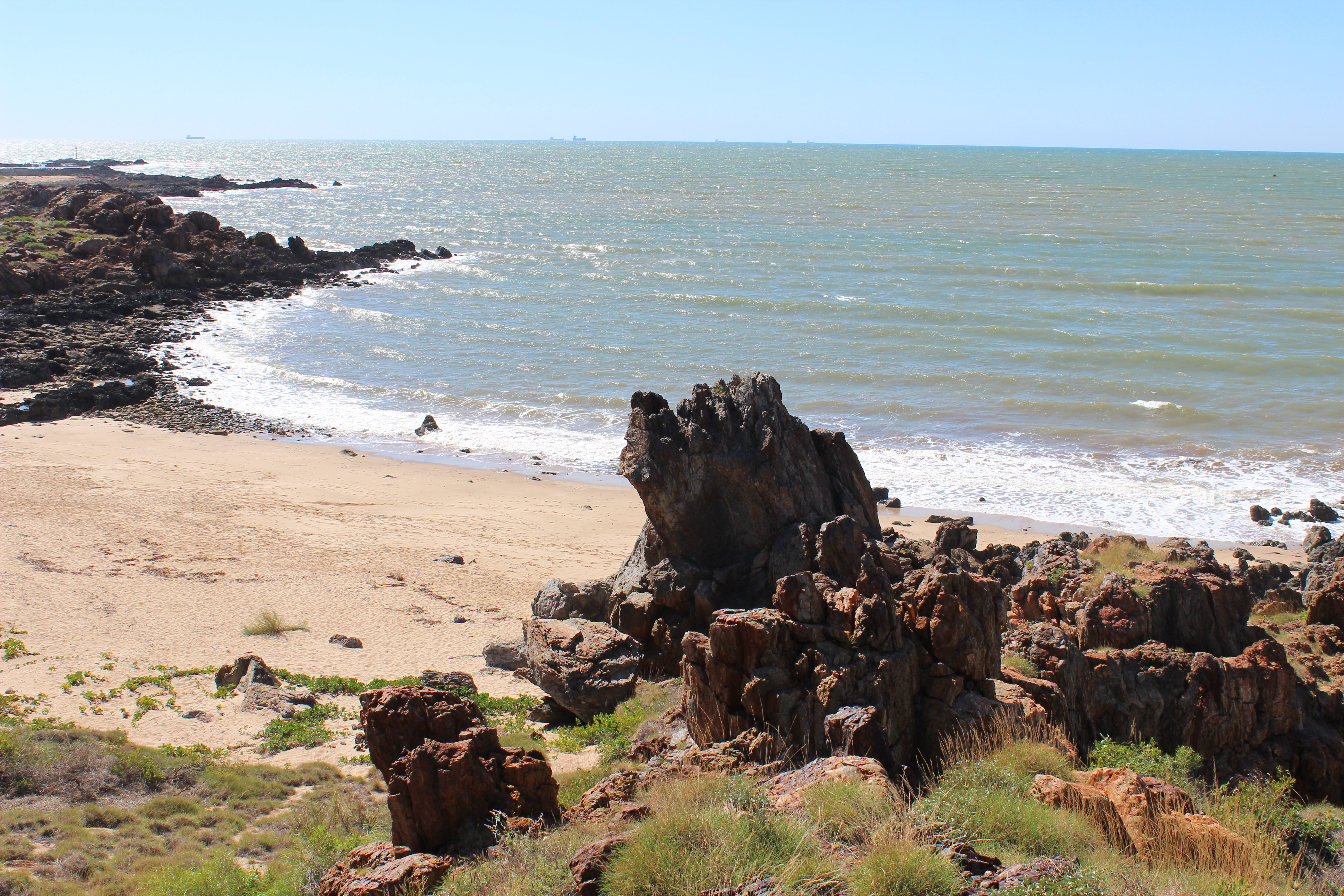
Tracking north from Exmouth through rural plains of vast cattle stations and deep red earth, that seemingly gets into every crevice and even turned the coat of our white Labrador into a light reddish tan, the landscape changed to magnificent hills and mountain ranges. We were pillaging the Pilbara Coast, with rugged hills, harsh red landscapes and home to large mining industries producing salt, iron ore, copper, fertilizers and natural gas.

Pilbara Landscape
The Pilbara region encompasses the towns of Karratha, Dampier, Wickham, Roebourne, Point Samson, Port Hedland and Cossack. Although it is all about the mining, the area offers travellers the opportunity to sail, fish or swim and explore the cultural history of towns like Cossack and Roebourne, the aboriginal heritage of Murujuga National Park located on the Burrup Peninsula and visit the amazing National Parks of the Hammersley Ranges – Millstream Chichester and Karijini National Parks.
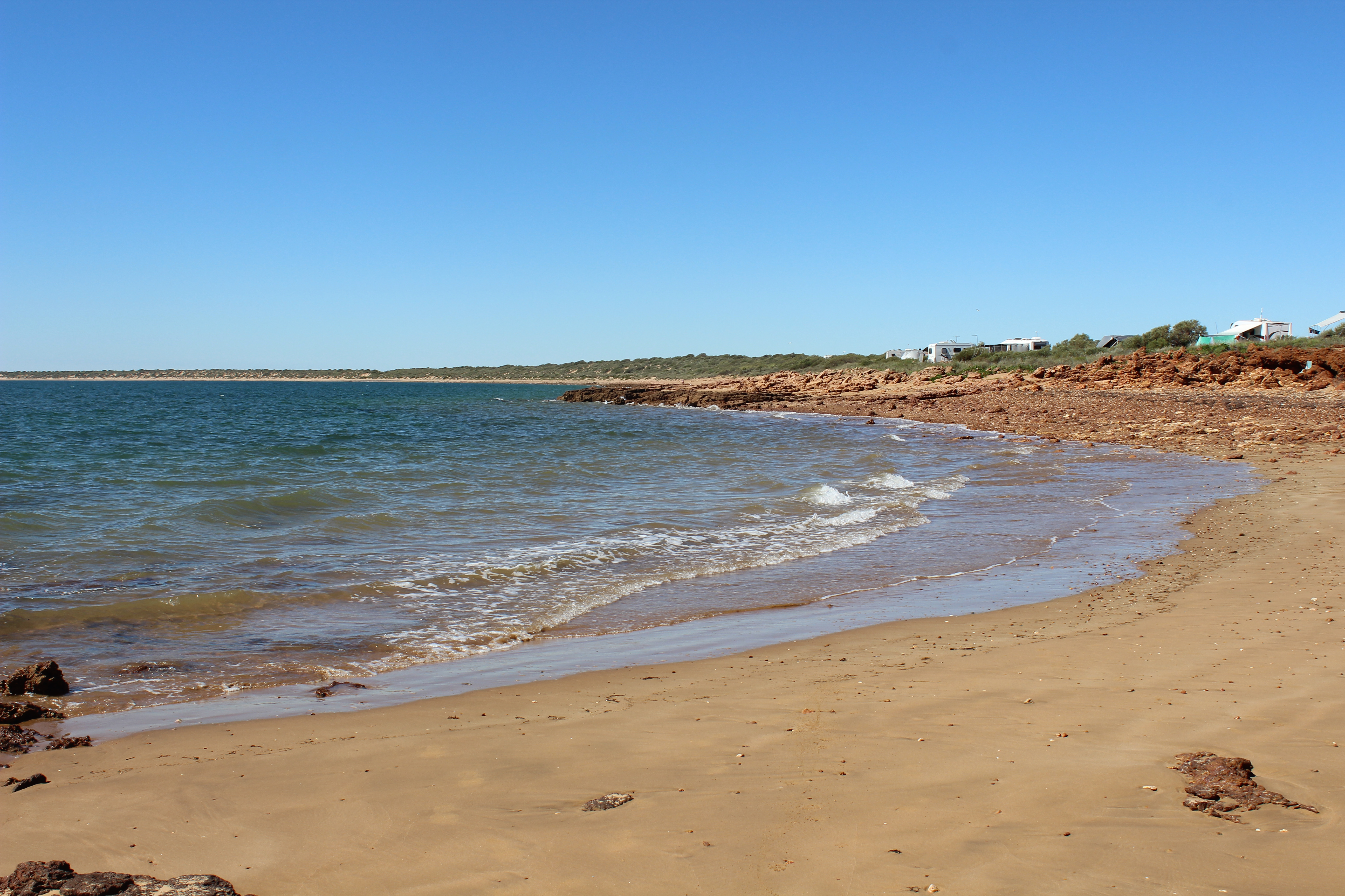
Forty Mile Beach Coastline
The towns of Dampier, Karratha and Wickham were established in 1963, 1968 and 1970 respectively, to cater for the booming mining industry. The region generates approximately 25% of Australia’s national economy through exports, taxes and royalties. Some of the world’s largest privately owned railways are also located here to serve the huge mines.
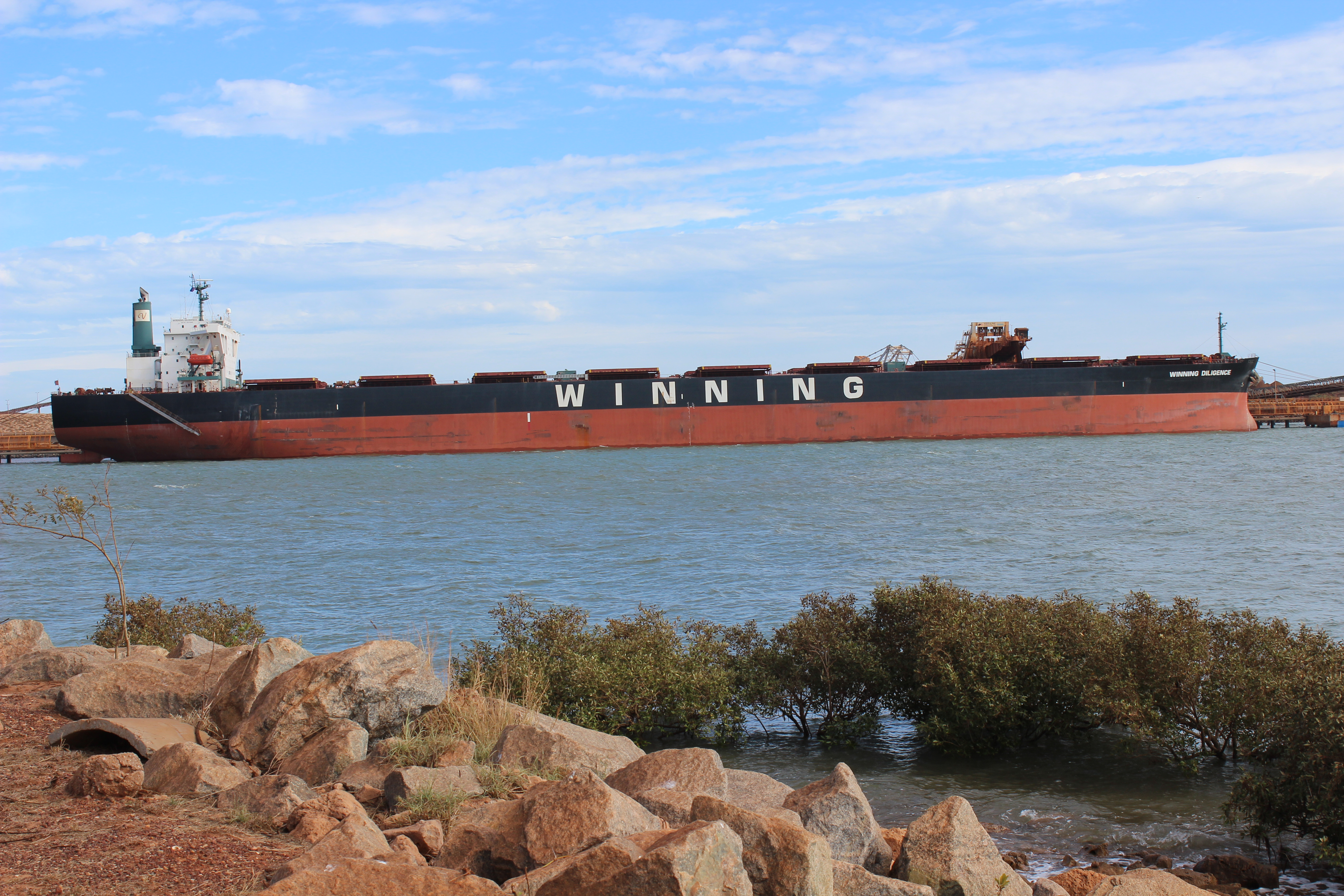
Nearby are some of the biggest iron ore mines in The Pilbara – Tom Price and Paraburdoo. Port facilities at Dampier and Cape Lambert are owned by Rio Tinto with two ship loading terminals which have the ability to load 10,000 tonnes of iron ore per hour.

Loading Iron Ore on Ships at Dampier Port
The Rio Tinto Iron Ore Rail Facility services 14 mining sites via a mainline system of approximately 1,500 kilometres of track. It hauls 290 million tonnes of iron ore per year to the port facilities. In addition Dampier Salt Mining Operations produce 4 million tonnes of salt per year which is used mainly in the chemical industry, for the production of plastics, glass detergents and a variety of chemicals.
Whilst in Karratha you can do a Pilbara Resources Tour giving you a behind the scenes look at the ore ship loading operations in Dampier. The tour includes the Dampier Salt Lookout, Parker Point and East Intercourse Island.
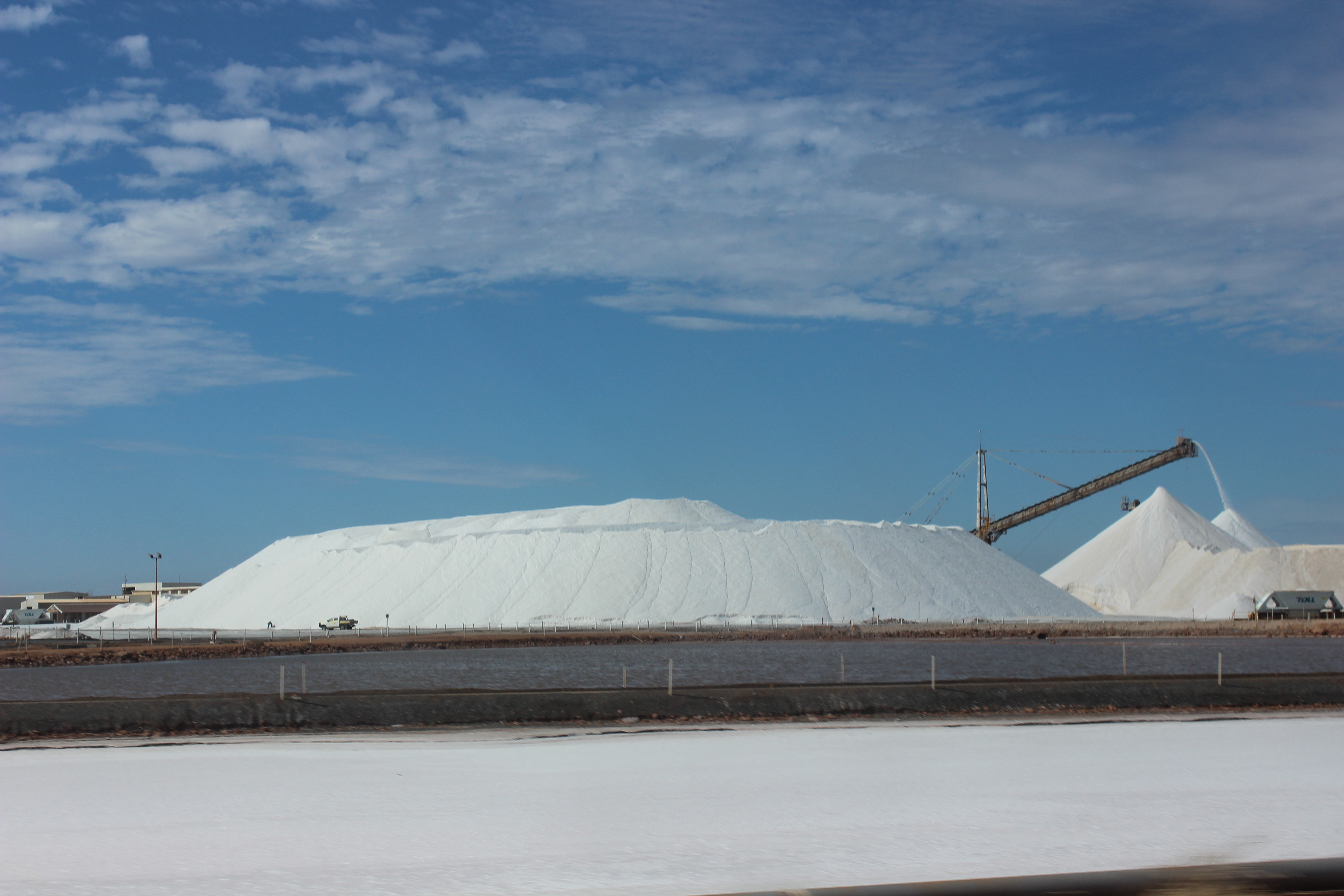
Dampier Salt Mine
Alternatively you can take the Rio Tinto Mines Tour visiting some of the biggest iron ore mines in The Pilbara – Tom Price and Paraburdoo, by bus from Karratha daily.
The Woodside operated North West Shelf Venture is Australia’s largest oil and gas resource development, accounting for more than 40% of Australia’s oil and gas production. The Karratha Gas Plant is located at Withnell Bay, between Karratha and Dampier, and is one of the most advanced integrated onshore gas production facilities in the world.

Karratha Gas Plant
You can learn more about the origins of oil and gas, from recovery, processing and transformation of energy, at the North West Shelf Project Visitors Centre located on the Burrup Peninsula, near the port of Dampier.
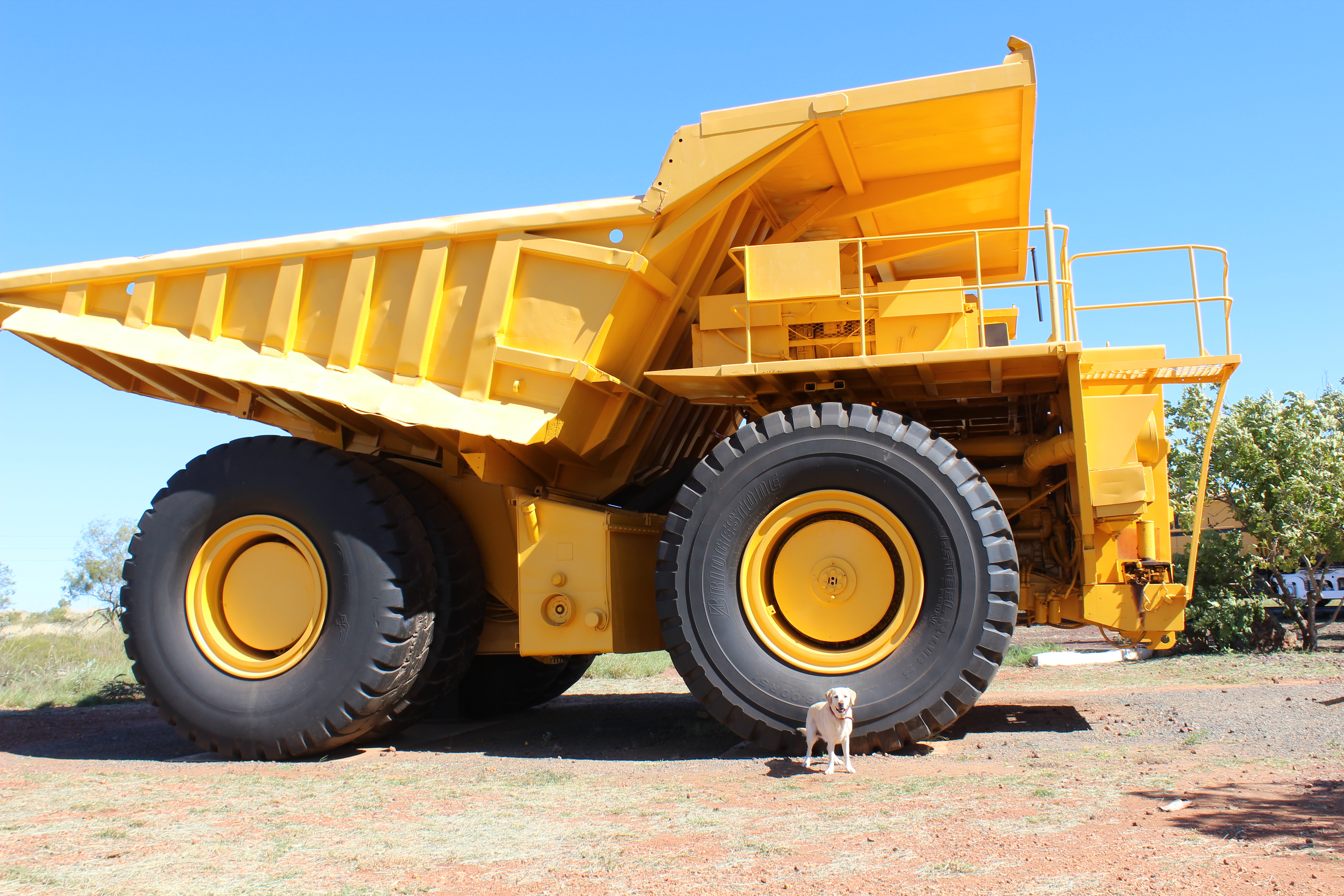
Huge Mines Dump Truck
Only established in 1968 and one of the fastest growing towns in Australia, Karratha is considered the shopping hub of The Pilbara with modern entertainment, educational and community facilities. It is a great place to base yourself to have a look around the surrounding areas with heaps of accommodation options.

Cleaverville Beach, Karratha
Climb Water Tank Hill lookout, above the Visitor’s Centre, for panoramic views of the new town or enjoy a cultural experience with a walk along Yaburara Heritage Trail. The trail covers a distance of 3.5 kilometres, highlighting the Karratha district’s natural history and cultural heritage, and in particular, the heritage of the traditional owners of this land, the Ngarluma people, and their neighbours the Yaburara people.
This port town named after the English explorer, William Dampier, is famous for the memorial to the legendary Pilbara Wanderer – Red Dog, located on the entry into the town. Not only is it one of the largest tonnage shipping ports in Australia, but it is also the departure point for boat cruises and fishing charters into the spectacular Dampier Archipelago.
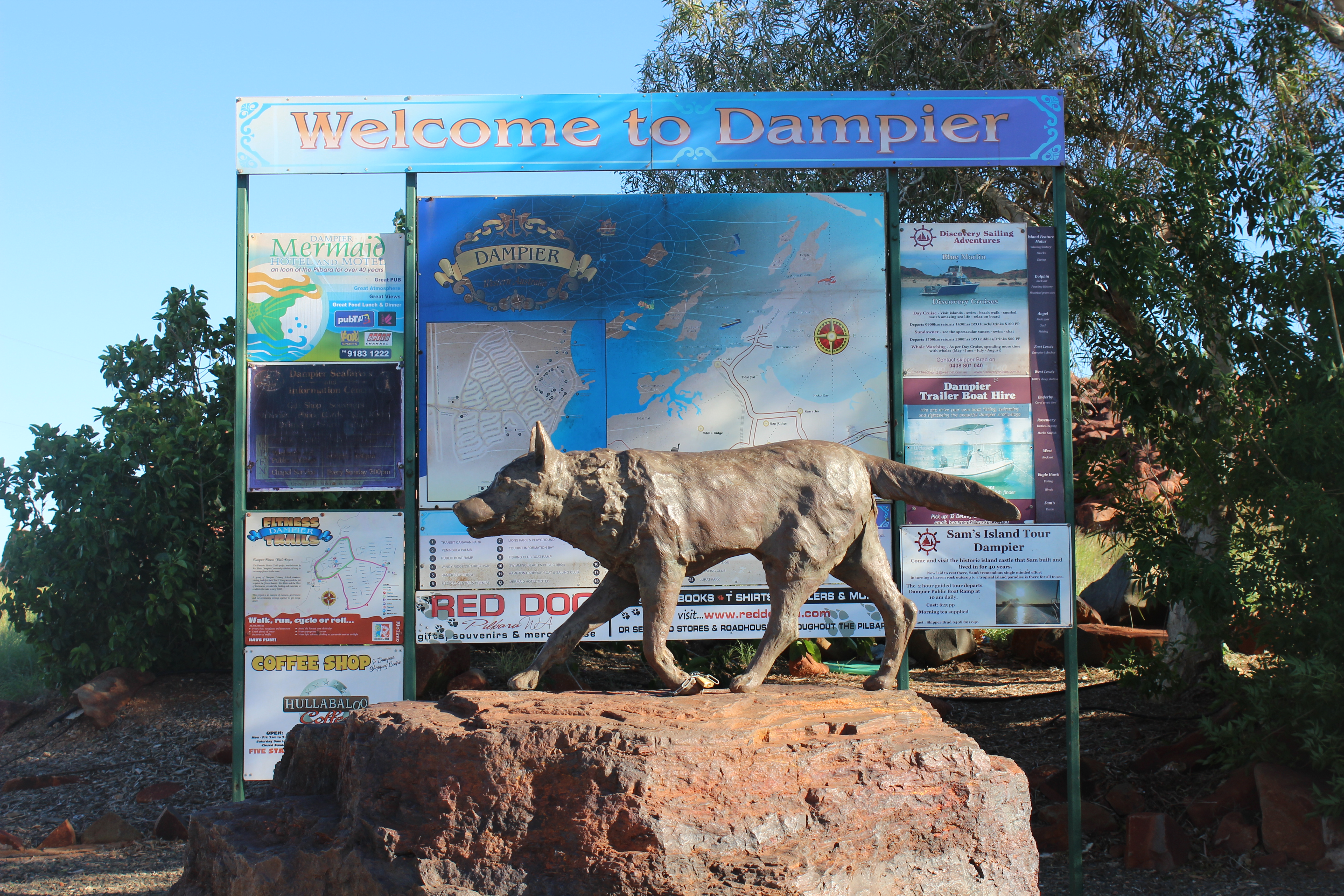
Red Dog Statue, Dampier
The Dampier Archipelago’s 42 islands offer excellent boating with many world-class snorkelling, diving and fishing locations. Boasting white sandy beaches and clear blue waters that are ideal for swimming or basking in the sun.
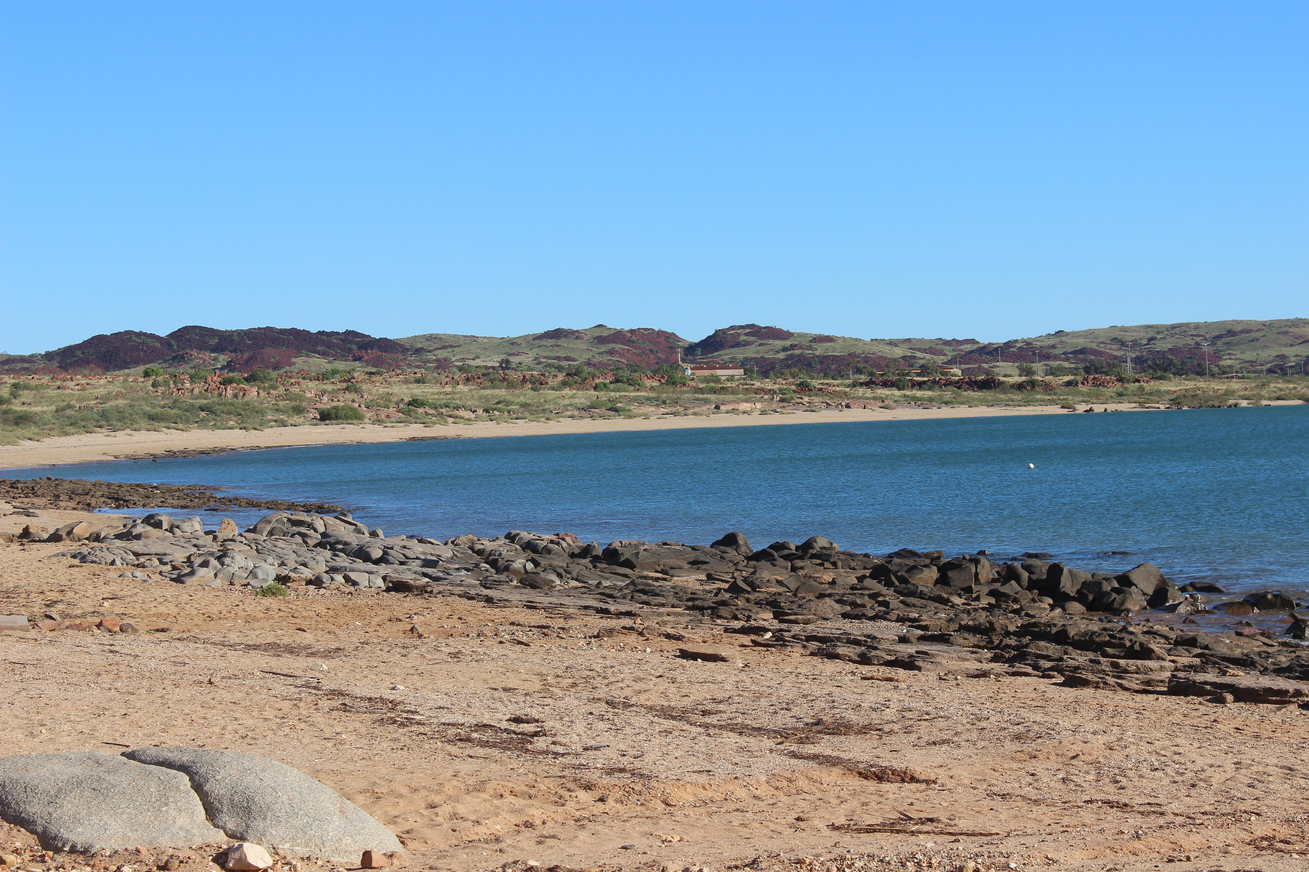
Dampier Beach
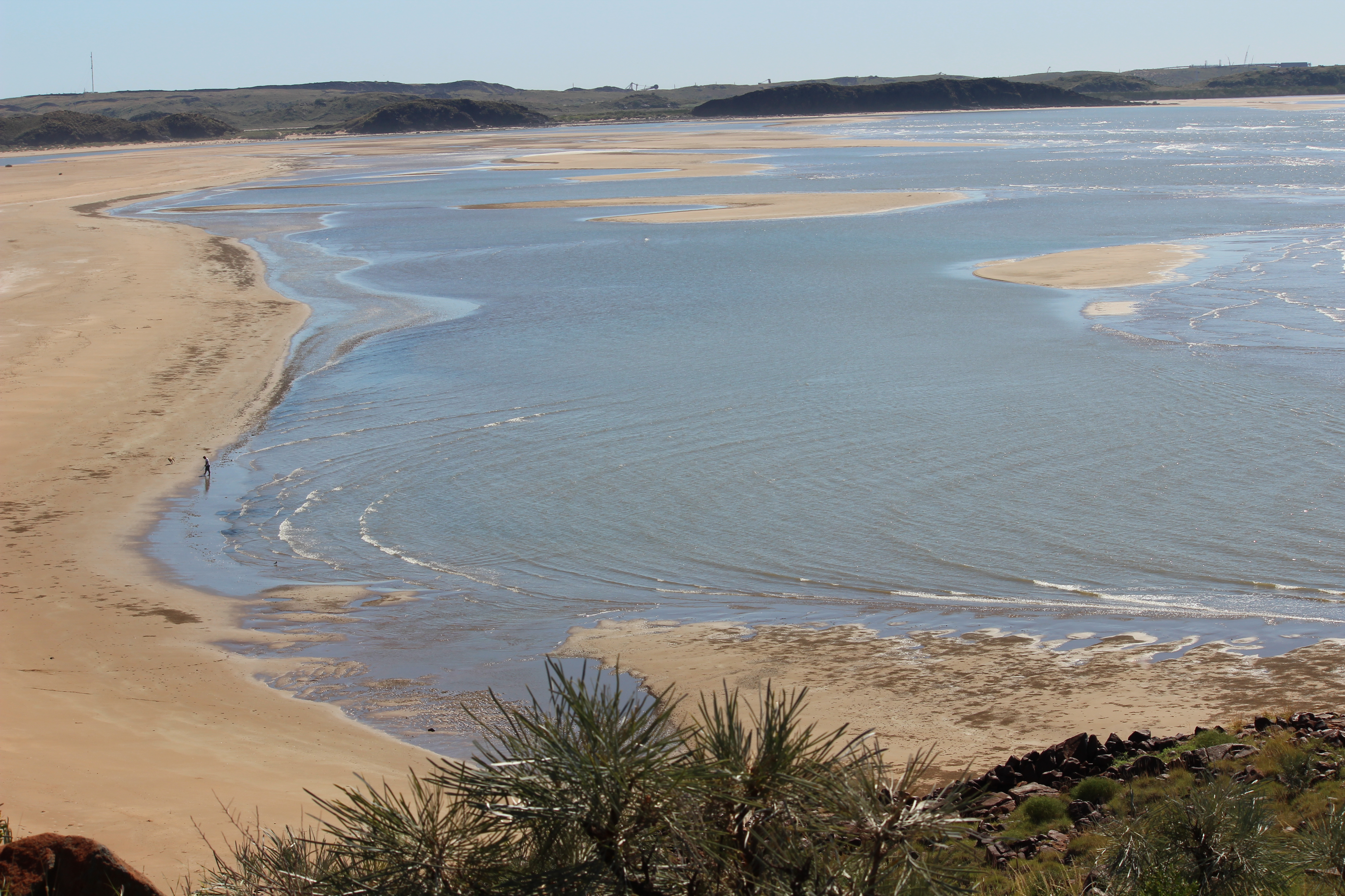
Dampier also has a beautiful sheltered beach with sandy shores, BBQ facilities, coconut palms, and parklands. A short drive away is Hearson’s Cove providing an excellent location to watch the ‘Staircase to the Moon’, as well as an ideal swimming and picnic spot.

Hearson’s Cove, Dampier
On your way into Hearson’s Cove, call into Deep Gorge to the see the Aboriginal rock engravings. Deep Gorge is recognized as one of the most prolific Aboriginal art sites in Australia, with over 15,000 individual rock engravings and etchings.

Aboriginal Rock Art at Deep Gorge, Dampier
If you drive further out along the Burrup Peninsula to the Murujuga National Park, which is private owned by the Murujuga Aboriginal Corporation, you will get an insight into the Aboriginal culture of the area. With a natural rugged beauty, the Murujuga National Park has outstanding scenic landscapes, accessible rock art and cultural heritage sites, a diverse range of flora and fauna, and opportunities for walking, swimming and snorkelling at some its pristine beaches.

Hearson’s Cove, Dampier
For an interesting look into the area’s past history, a trip out to the ghost town of Cossack is mandatory. Located on the mouth of the Harding River on the coastal strip between Point Samson and Dampier, the port town was formerly known as Tien Tsin. It was established in 1871 as the first port in the North West and was critical to the development of the pastoral industry in the region.

Harding River, Cossack
Cossack was also the birthplace of Western Australia’s pearling industry and was home of the colony’s pearling fleet until the 1880’s. There were up to 80 pearling luggers operating in the area, and by 1884 more than 400 people were living in the township.
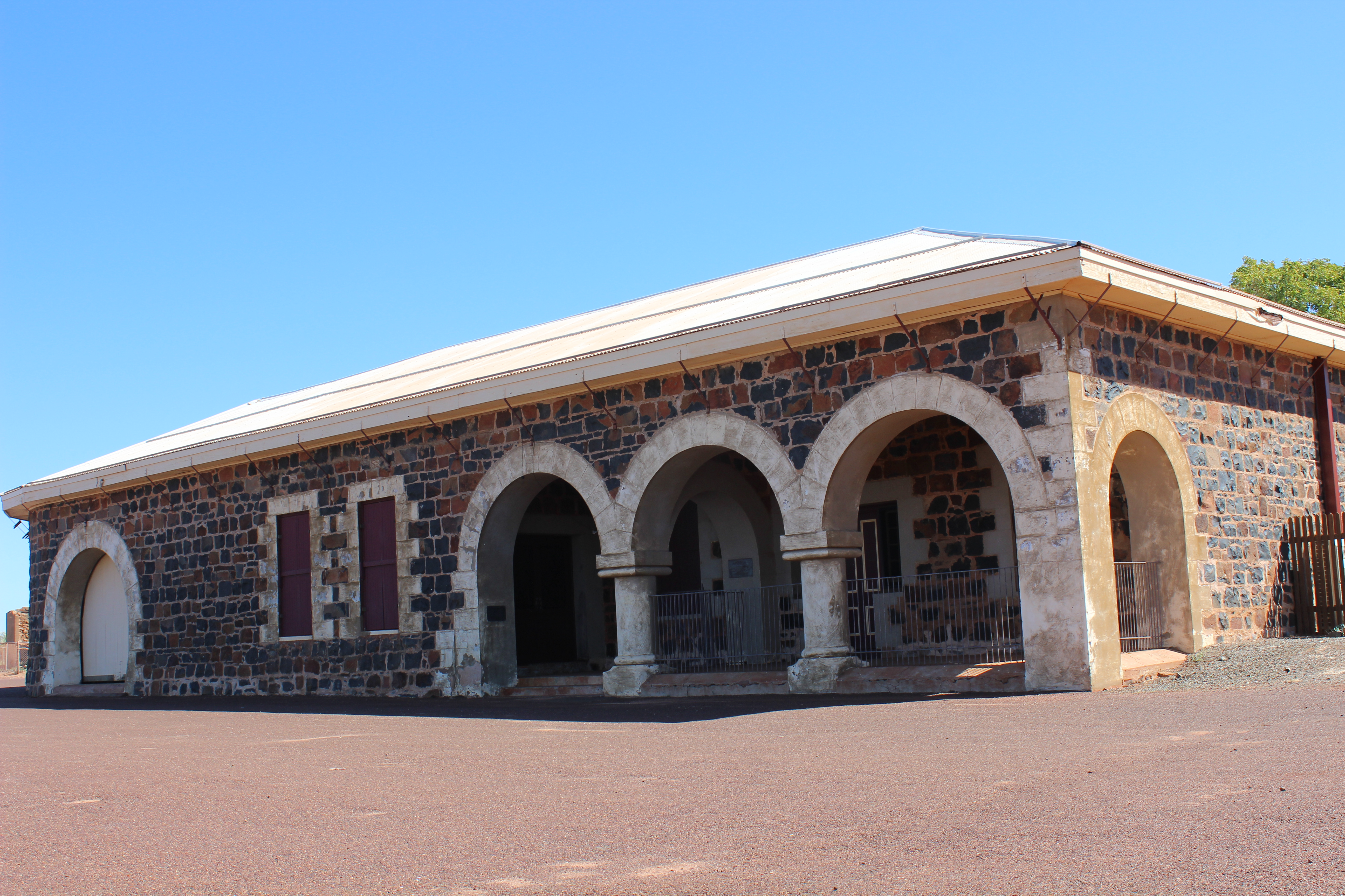
Old Customs House, Cossack
However, it wasn’t pearls that were sought after, it was Mother of Pearl shell which was used for the production of buttons. The shell was collected initially by the slave labour of local aborigines by hand from the creek beds and beaches. Later shell had to be collected by divers at ever increasing depths. The most profound reminder of this once booming industry is the Japanese cemetery where some of the divers are laid to rest. Others, including many aboriginals who were employed as divers, were also lost at sea.

Cossack Courthouse
The Pilbara gold rush of the late 1870’s coincided with the growth of the pearling industry to bring real prosperity to Cossack and in 1877 a horse drawn tramway was constructed to link Cossack to Roebourne. Cossack’s growth spanned nearly 40 years, however its decline was far more rapid. By the turn of the century the pearling fleet had moved to Broome and the gold rush had diminished as prospectors moved to other fields. The municipality of Cossack was dissolved in 1910, however people still lived there after World War II.
Settler’s Beach, Cossack
Nestled along the West Pilbara coastline, Point Samson was established as a deep water port to service Roebourne and surrounding districts in 1904, due to silting problems at Cossack. Although small, for many years Point Samson handled the third largest port tonnage of iron ore in Western Australia.
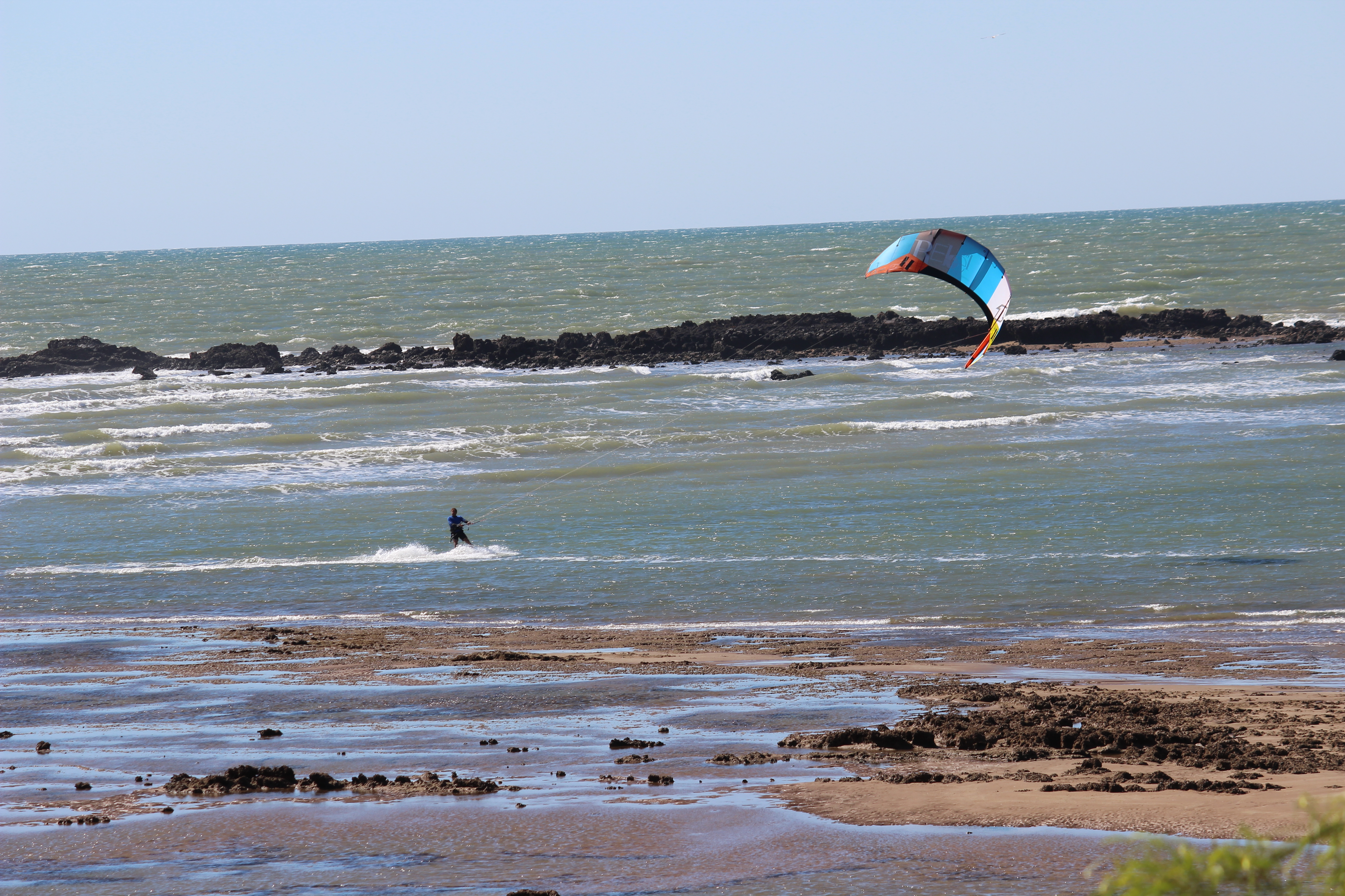
Kite Surfer at Point Samson
The beach is bordered by a coral reef which makes for an environment of calm waters, safe swimming, snorkelling and game fishing. Under tidal conditions the point is only connected to the mainland via a causeway over Pope’s Nose Creek. Nearby is the secluded Honeymoon Cove and beyond is John’s Harbour where there is a jetty and boat ramp.
Honeymoon Cove, Point Samson
The town provides 4.5 star resort accommodation, several boutique style B & Bs, modern caravan parks and holiday homes. It also has a reputation for some of the finest seafood restaurants, or enjoy a drink at the Tavern.
Settled in 1866, and located 39 kilometres east of Karratha on the banks of the Harding River, Roebourne is the oldest settlement in the North West. There are many fine historic stone buildings that remain in Roebourne as a constant reminder of the early days. The Old Gaol, which is now a museum and Visitor’s Centre, is a perfect example, offering an insight into pioneer and Indigenous history.
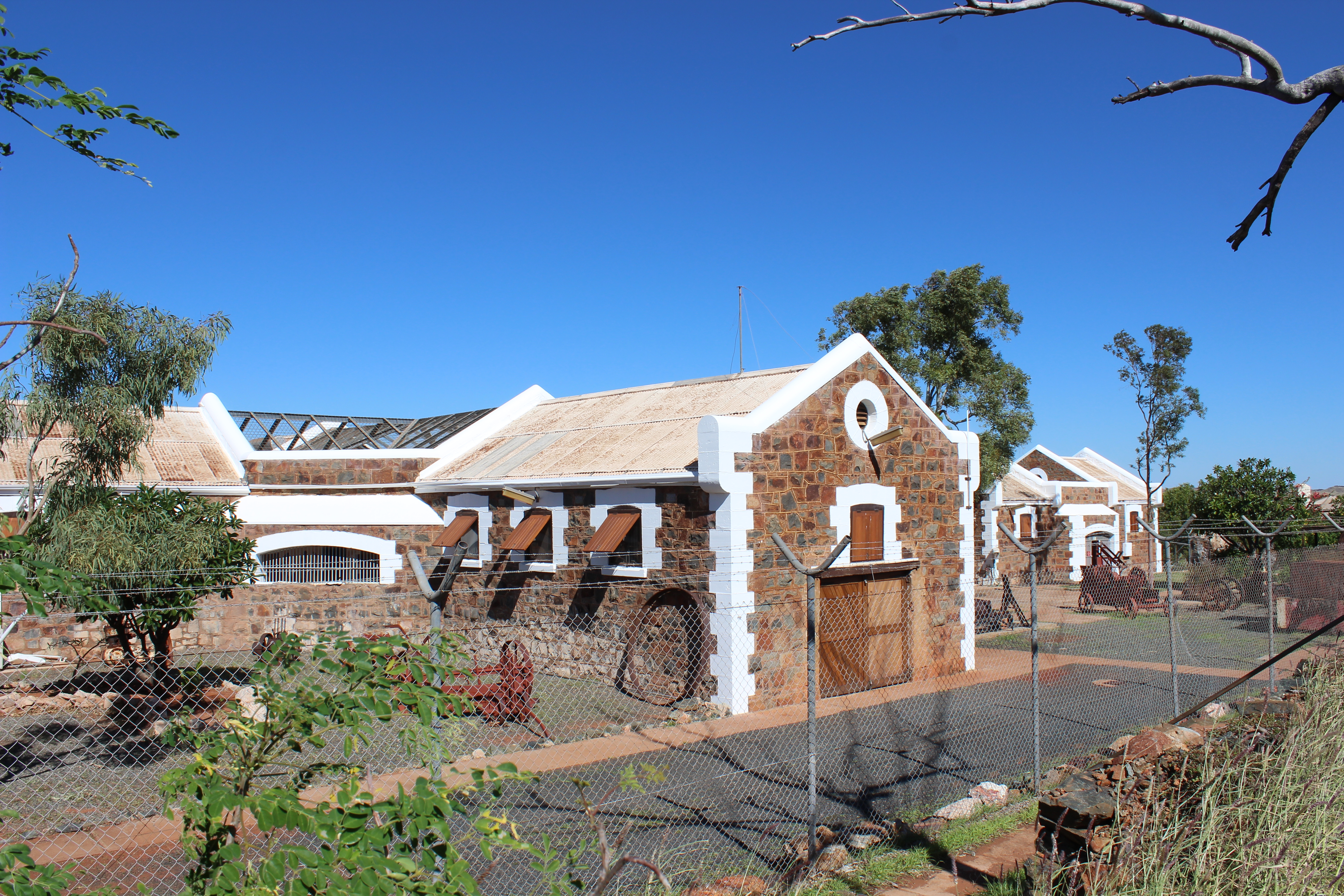
Old Roebourne Gaol
Other historical buildings worth a look are Watson’s Tee Store, Freddie Ye Paik’s Store and Bakery, the Holy Trinity Church, the Roebourne Post Office and Dalgety House. A guide to significant buildings in the Roebourne township is available from the Visitor Centre.

Welcome Sign at Roebourne
Roebourne is home to several world renowned Aboriginal artists, whose work can be seen at the Yinga-Barni Art Centre and the Roebourne Art Group. A drive to the top of Mount Welcome behind the town offers panoramic views of the town, coastal plains and rugged hills.
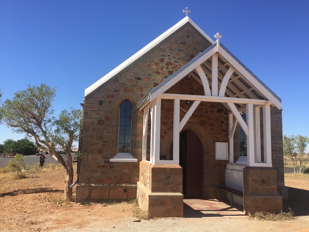
Holy Trinity Church
The Emma Withnell Heritage Trail is a 52 kilometre drive and walk trail which retraces the settlement of the Roebourne district. It takes in Cossack, Wickham and Point Samson and you can get a map from the Roebourne Visitor’s Centre.
Approximately 220 kilometres north of Karratha, Port Hedland is a small town which is renowned for its massive resource industry, long trains, big ships and salt piles.In addition to being the world’s largest bulk commodity export, Port Hedland has become an increasingly popular port of call for cruise ships.

BHP Billiton Iron Ore Port Facility
But really Port Hedland is BHP Billiton town with its port facilities, kilometre long trains and BHP headquarters dominating the skyline. One of the must do things in Port Hedland is to tour the massive BHP Billiton port facilities and the salt mine operations. Otherwise enjoy the harbour from the parklands and observe the movement of the gigantic ore-carriers and salt ships passing through.
Ship being loaded with iron ore, Port Hedland
Take a step back in time and visit Dalgety House for an insight into Port Hedland’s pastoral history or wander through the open air Don Rhodes Mining Museum which exhibits mining equipment from the days gone by.

Don Rhodes Mining Museum, Port Hedland
The vast expanses and the rugged landscapes of The Pilbara took on a beauty of of it’s own. Although I found the massive mining industry that dominates the region to be interesting I couldn’t help but feel that their continued pillaging, blasting of mountain ranges and excavating huge pits in the ground will eventually take it’s toll on the natural beauty of the land. Let’s hope not!
Comments are closed.


Pinky Poinker
July 8, 2014You had me at “Red Dog” Kathy! You are tagged in my most recent post :)
Kathy
July 9, 2014I have probably cried through the Red Dog movie on more than one occasion! There was something special about standing next to his statue.
Johanna
July 8, 2014It looks awe-inspiring if not slightly desolate, but I guess that’s part of its charm. I’d love to visit the far north, Dampier sounds amazing and yep, you had me too at Red Dog!!
Kathy
July 9, 2014It was a very interesting part of the North West Jo. I don’t think I could live there tough. Too much mining and destruction of the land for my liking!
bmpermie
July 10, 2014Great pictures. I haven’t been to WA between Perth and Brooome but will do Canning Stock Route in August. Coast will have to wait.
How much didyou spend on this section Cathy.
Kathy
July 10, 2014I would have loved to have gone inland to Karijini NP and Millstream Chichester NP but because we are travelling with a dog National Parks have been limited to day trips in only. We spent about a week in the Pilbara and then moved onto Broome.
Kathy
July 10, 2014By the way you are mentioned in my blog tomorrow.
bmpermie
July 10, 2014Me! BTW perhaps for poor proof reading. My question was meant to read How much time did you spend on this section of the coast.
Karratha
August 10, 2014Your post brings lot of information which is so helpful in the field of our business. Thanks for sharing this type of post for all of us… I really enjoy this blog so much….
Kathy
August 10, 2014Thank you, I’m so glad that I was able to capture what I found so interesting and intriguing about the Pilbara Coast area. I hope you continue to enjoy my posts.