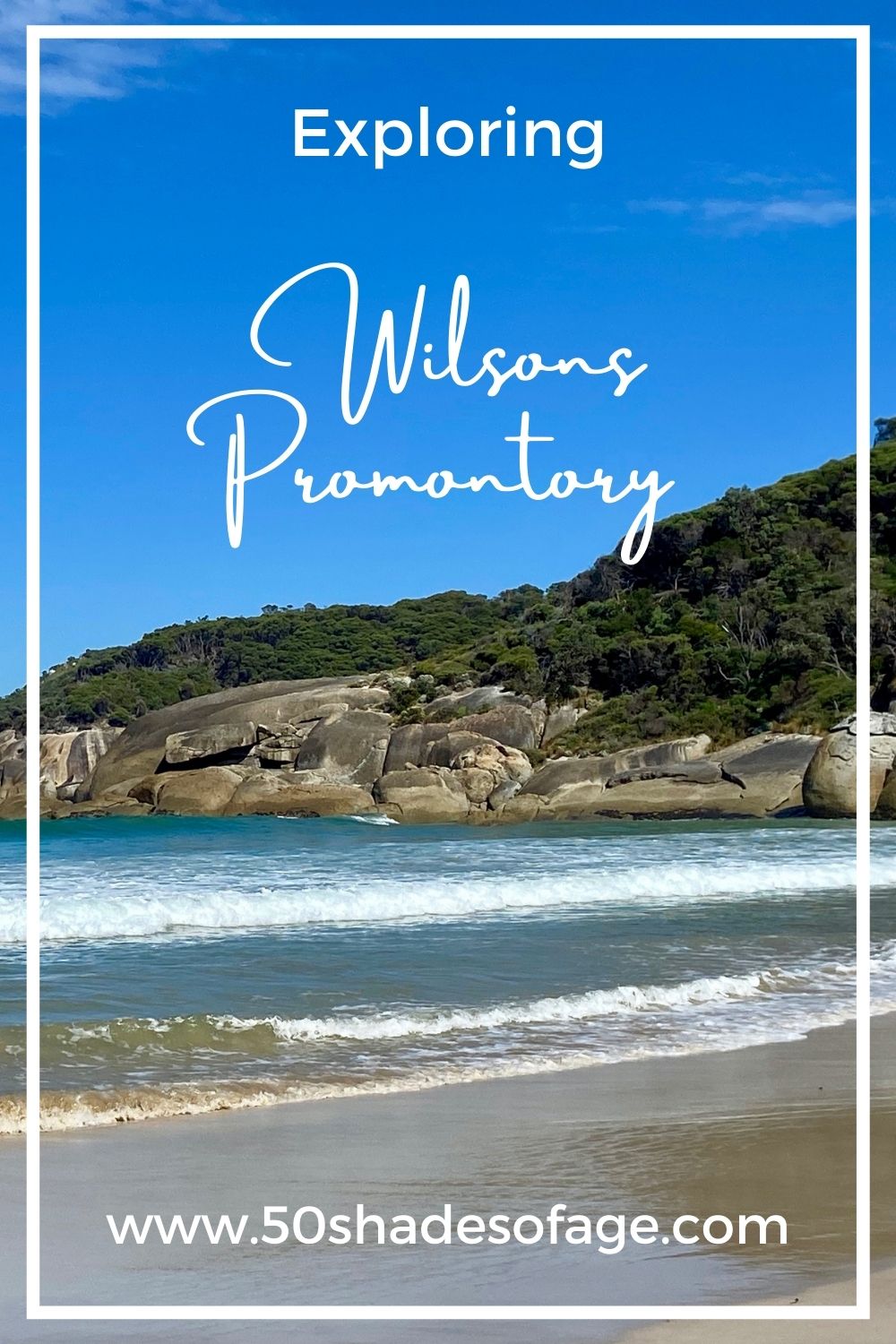
Described as Victoria’s largest wilderness areas, Wilsons Promontory is a special place to behold and treasure. With its bounty of nature’s gifts such as native wildlife including: kangaroos, emus, wombats, echidnas and colourful birds like rosellas. Spectacular displays of wildflowers including: orchids, wattle, heathland and other species. There is no wonder it is one of Victoria’s best loved national parks. We spent three days here exploring Wilsons Promontory, also known as “The Prom” or “Prom Country”.
Located at the most southerly point of the state of Victoria in Australia , Wilsons Promontory is 240 kilometres south-east of Melbourne. It takes around 3 to 3.5 hours to drive here, with stops along the way. The peninsula juts out into the Bass Strait and is protected by the Wilsons Promontory National Park.
We drove from Phillip Island via the Bass Coast, stopping at several places of interest along the way. Kilcunda, Wonthaggi, Cape Paterson and eventually Inverloch, where we stopped for morning tea.
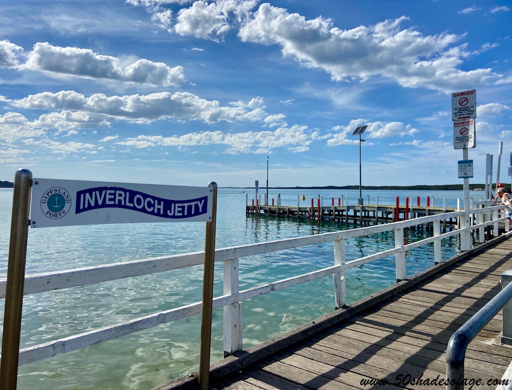
Located on the protected waters of Anderson Inlet, off the Bass Strait, Inverloch is a pretty seaside town. The name Inverloch is a Gaelic word meaning “entrance to a lake”. Once a thriving fishing port, it is now a quiet resort town popular with holidaymakers.
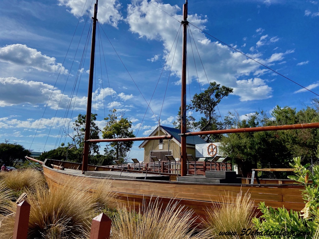
The historic shipwreck, the Amazon was discovered here buried under the sandy beach after almost 160 years. The Amazon 1863 Project have built a replica ship, actually a three-masted barque, and have preserved some significant Amazon artefacts, the site and written records. We spent some time here photographing the replica ship and reading about its history. You will find it along Inverloch foreshore near the Bowls Club.
A fabulous place to stay in Inverloch is on one of the grassy camping sites at the Foreshore Camping Reserve located along the sand dunes of Anderson Inlet.
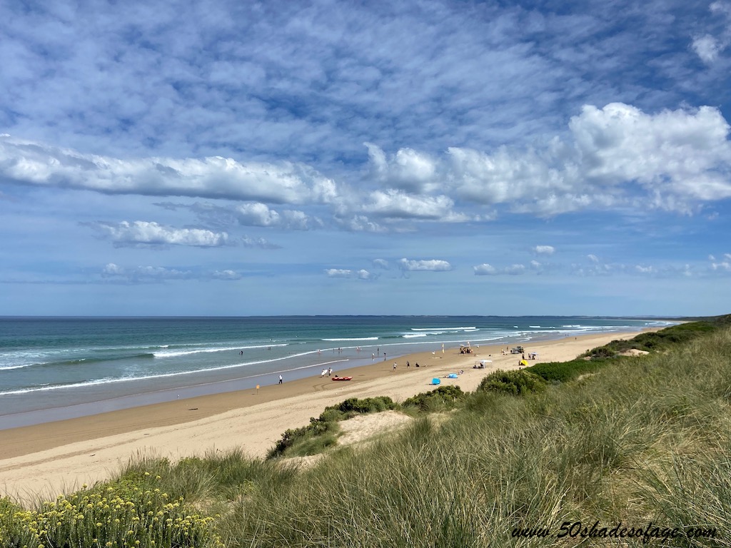
As well as the calm, safe waters of Andersons Inlet, Inverloch also offers a 1.8 kilometre long surf beach that is patrolled by lifeguards during peak times.
For walkers there is the Screw Creek Townsend Bluff Estuary Walk that passes through coastal bushland and mangroves. From Townsend Bluff scenic views over Anderson Inlet can be enjoyed.
Take the 12 kilometre scenic Bunurong Coastal Drive from Inverloch to the seaside community of Cape Paterson, fronting Bunurong Marine Park. This drive has been compared by some as a scaled down version of the famed Great Ocean Road.
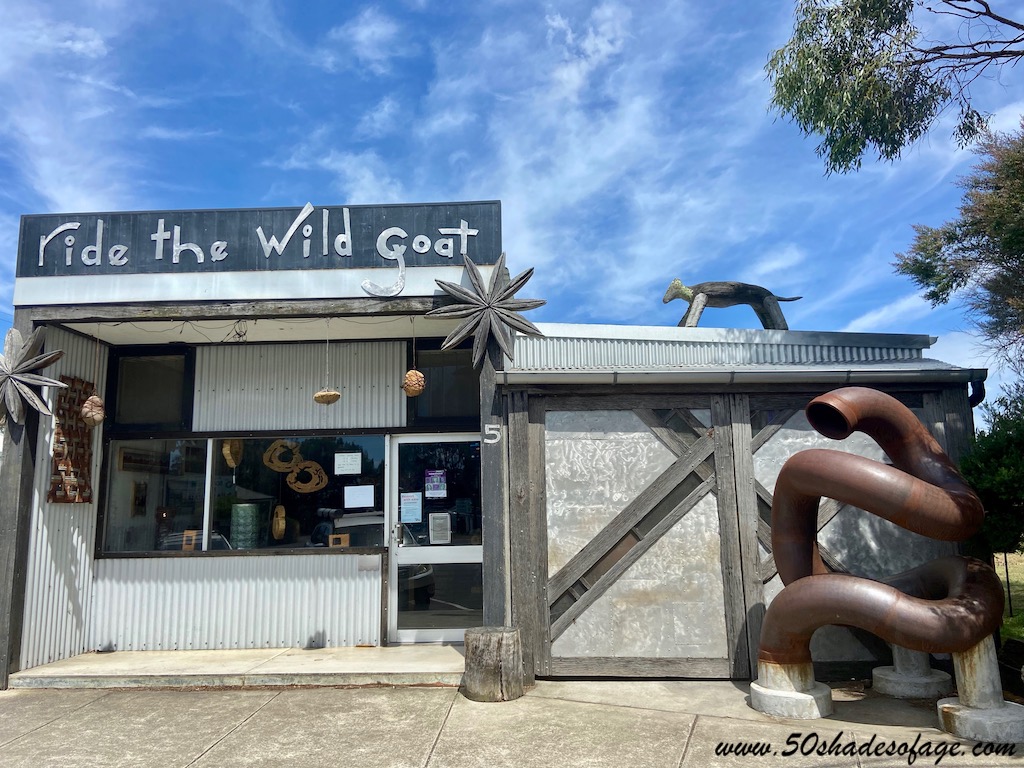
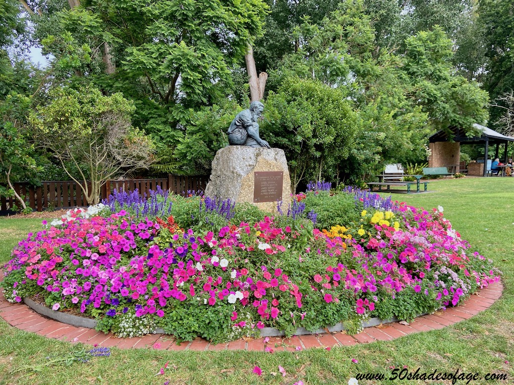
Once we left the Bass Coastal drive, we headed east toward the quirky town called Fish Creek. We had heard good things about this place, so we were eager to check it out. There is a definitive “fish” theme throughout the town and it is renowned as an arts and culture hub in South Gippsland.
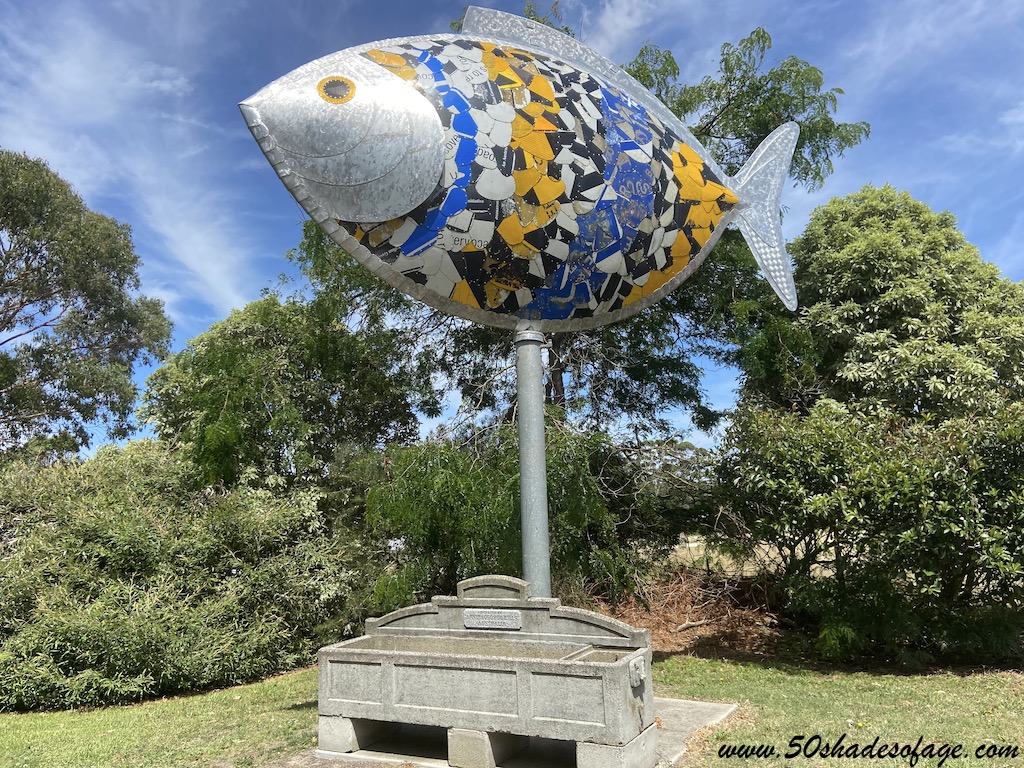
We stopped at the art-deco style Fish Creek Hotel, complete with a mullet on the roof. Popped into Ride the Wild Goat to check out their furniture and artwork made from salvaged goods. Walked by the old Fish Creek District Butter Factory and the iconic rotating fish sculpture, to the main street. Here it was like a walk down history lane with its original buildings and shops lining the street, dotted with cafes and galleries.
From Fish Creek you can access the Great Southern Rail Trail and walk, ride or cycle to nearby Foster or Meeniyan. But it is also accessible to Wilsons Promontory and a great alternative for accommodation.
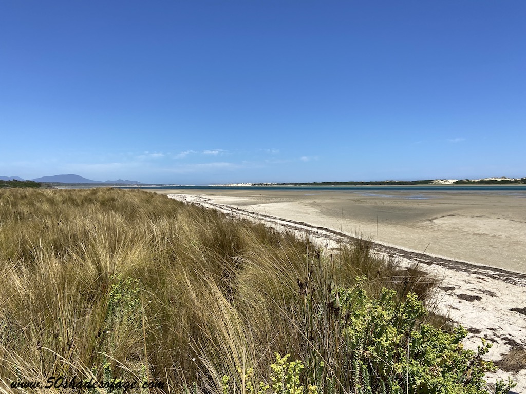
Our final stop and our choice for our three day stay, was in the town of Yanakie, that is located on the narrow strip of land that joins the Wilsons Promontory National Park with the Bass Coast. Our choice of accommodation was at the Yanakie Caravan Park located outside of town at Corner Inlet right on the waterfront with amazing views towards the Prom.
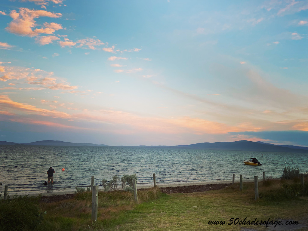
We chose this spot because of its close proximity to the entrance to Wilsons Promontory, only 5 kilometres away, and because it was pet friendly. The caravan sites here were grassy and generously sized with hedges separating the sites. We could almost cast a fishing line into the water from our waterfront site.
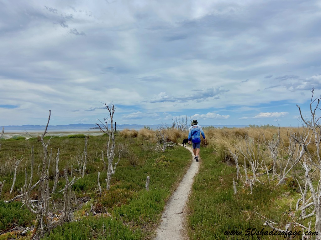
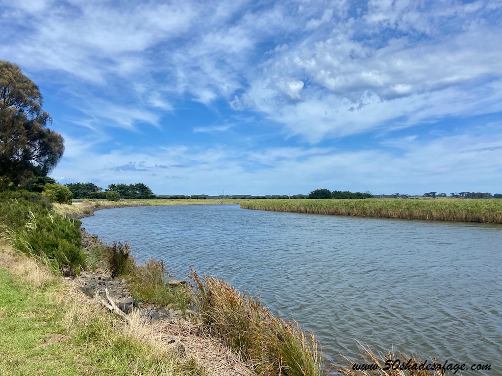
After we set up camp, we decided to take a hike out to Duck Point under a canopy of paperbark trees, grass trees and then through dense red tussock grass. We stood at Duck Point and took in the incredible panorama set before us of Corner Inlet and the granite peaks of Wilsons Promontory.
Yanakie is also a fisherman’s paradise with boat access near the caravan park and fish species including snapper, whiting, flathead, kingfish and gummy sharks.
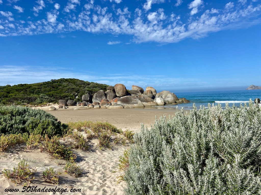
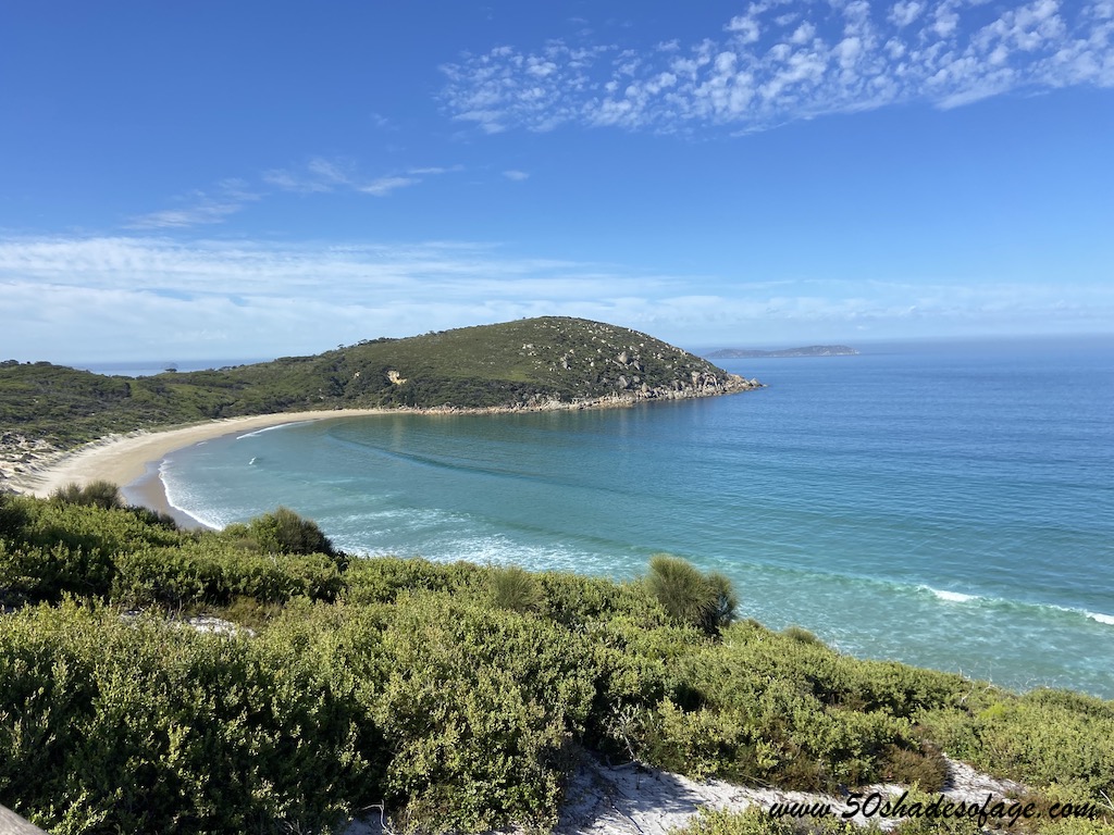
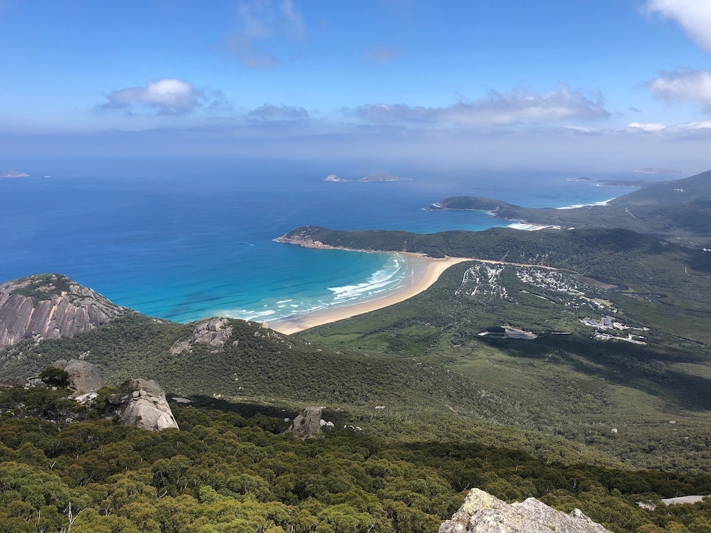
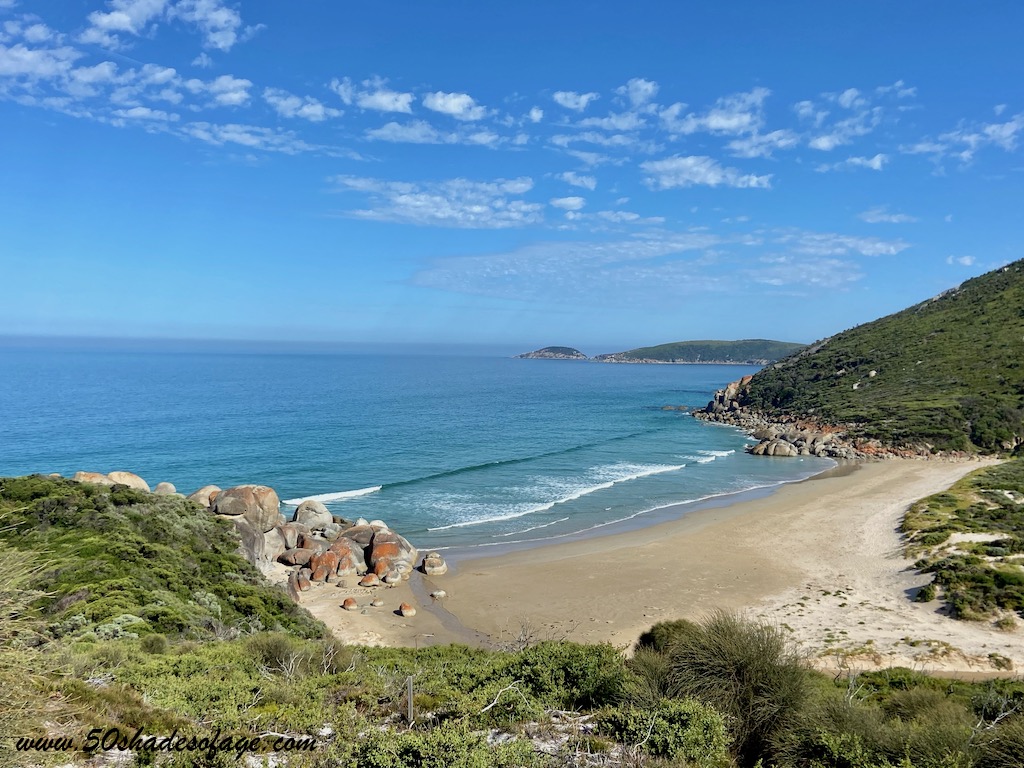
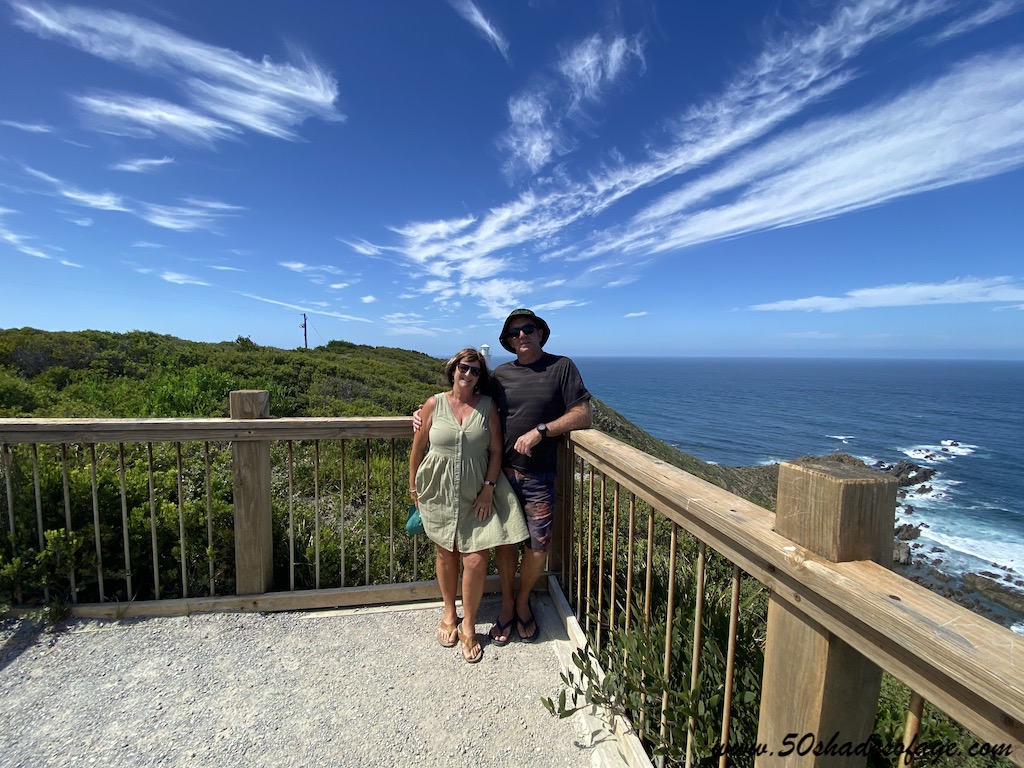
We set off early the next morning to attack The Prom armed with the map that we obtained from the caravan park office. As we drove into the park it was immediately evident that something special was about to unfold. We were awestruck by the natural beauty surrounding us and at every turn there was a viewpoint over the pristine western coastline of the promontory.
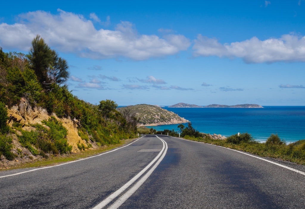
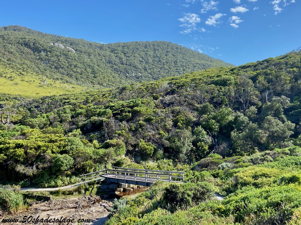
The national park is immense, 505 square kilometres of rainforest, granite peaks, golden sandy beaches, dense vegetation and abundant wildlife.
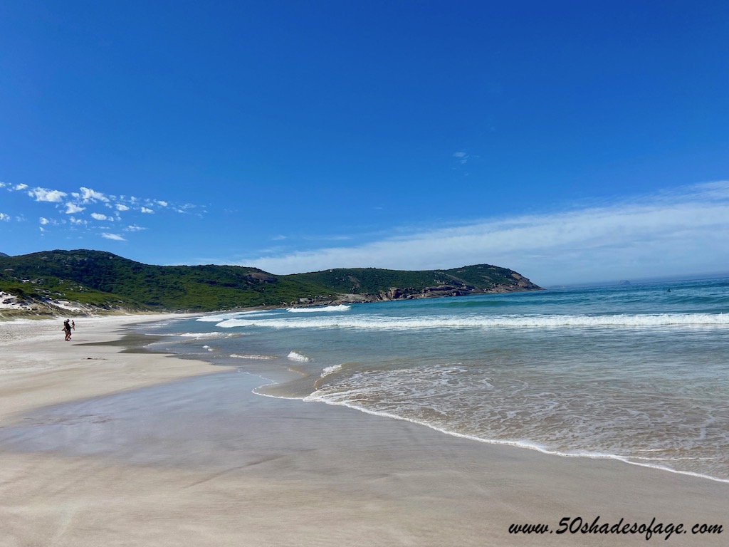
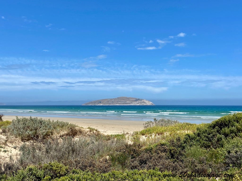
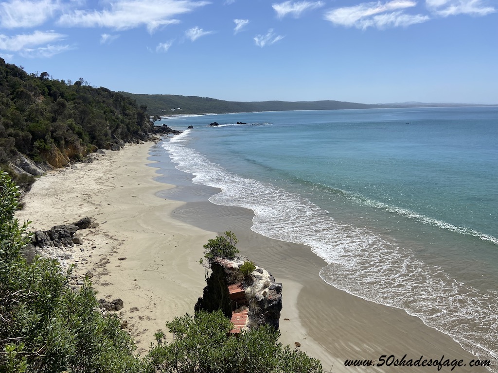
Depending on your fitness level and time available there are plenty of walking trails to hike and immerse yourself into the beauty of the Prom. Otherwise you can take shorter walks to some of the pristine beaches on the western side of the promontory.
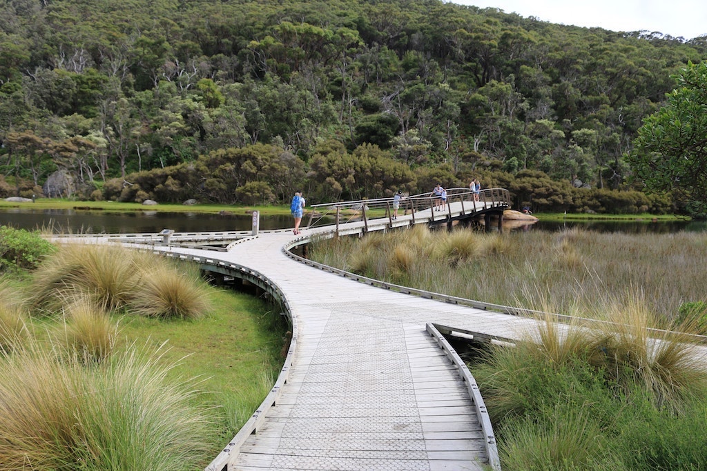
Wilsons Promontory is notorious for being a walker’s paradise with a myriad of walks of various lengths and fitness levels. If you only have enough time to do some short walks to be wowed by some of the amazing coastal views over Wilsons Promontory’s pristine beaches, then these short walks are ideal for you:
Short walks near Tidal River include:
Other Wilson Promontory walks for those wanting to experience the northern end of the Prom, include:
To download a walking trail map of Wilsons Promontory head to Parks Victoria.
For hard core hikers and nature lovers, the best place to base yourself in Wilsons Promontory National Park is at Tidal River. There are a variety of accommodation options within Tidal River. From Wilderness Retreats for a quiet getaway for one or two, to Group Lodges that can accommodate up to 30 guests. And of course, the grassy campsites in the campground nestled amongst the tea trees.
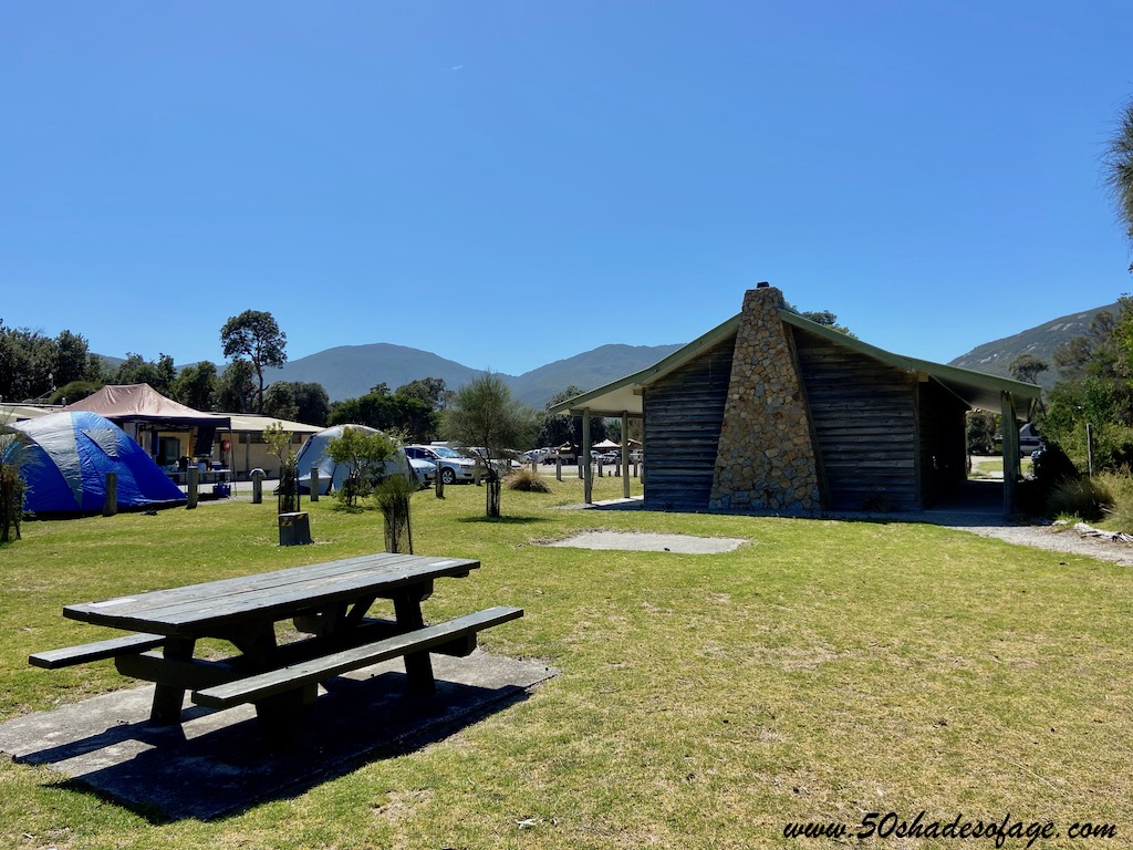
There are 484 camping and caravan sites, but they are extremely popular and you need to book ahead. During peak times campsites are allocated by a ballot system. Amenities at Tidal River include a general store with a cafe that offers takeaway meals, visitor’s centre, large grassed area, children’s playground, drinking water, flush toilets, hot showers, laundry facilities, camp kitchens, picnic areas with gas barbecue grills, and a dump station.
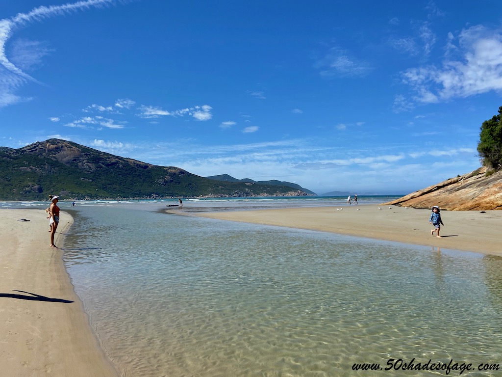
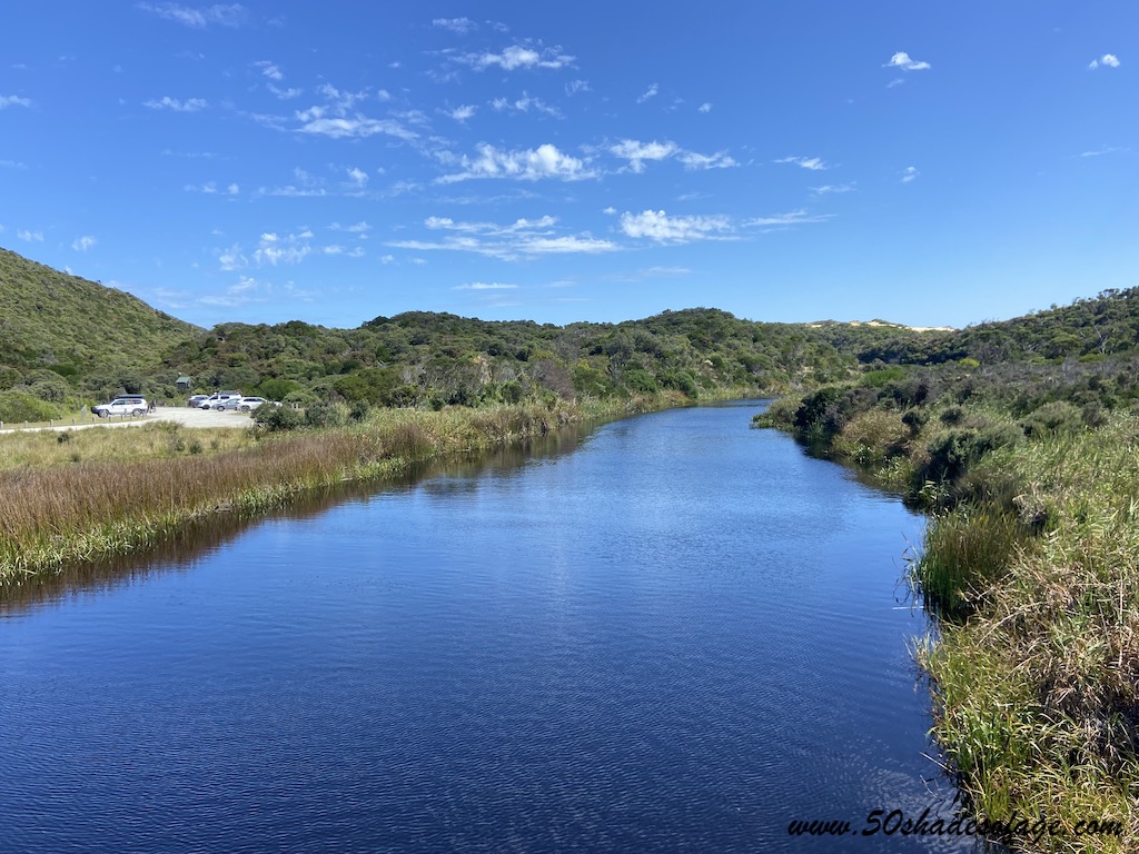
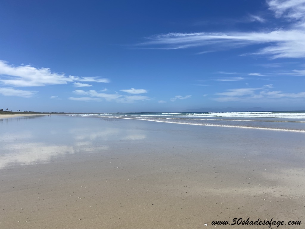
Tidal River is flanked by a river that is great for swimming and fishing, and has easy access to Norman Beach. There is also good wildlife viewing surrounding the area at dawn and dusk when the kangaroos, wallabies, and wombats are most visible.
Yanakie is the closest town to the Wilsons Promontory, being only 5 kilometres from the entrance into the national park. There are several options in Yanakie including:
During our three day stay we ventured to a couple of other places in the area that were only a short driving distance away from Yanakie.
Located 30 kilometres south of Inverloch, Venus Bay boasts five superb beaches and the state’s longest sand spit. The beaches are very popular for beach goers and surfers during the summer months. It is also a great spot for beach fishing.
There are a couple of accommodation options in Venus Bay, including a caravan park, holiday homes and an eco retreat.
Tip: For walkers take the 6 kilometre Point Smythe Nature Trail that takes you through dense coastal vegetation.
This fisherman’s paradise is idyllically situated on the Tarwin River, not far from Venus Bay. The town centre features a small supermarket, service station, the Riverview Hotel, a few other commercial outlets, a hall and church.
The pathway between Venus Bay and Tarwin Lower is great for walkers and cyclists. There are several fishing and viewing platforms built along the shores of the Tarwin River and attractive picnic areas.
Tip: Whilst here visit the Bald Hills Wetlands Reserve and stroll through the open woodlands.
From Tarwin Lower we took the 22 kilometre drive to Walkerville and Cape Litrap. This small coastal settlement does not offer much in the way of shops or eateries, but is very scenic and historically interesting.
A drive out to Cape Liptrap and walk to the lighthouse and viewing platform afforded us stunning views of the coastline.
We took the clifftop walk, near the boat ramp at Walkerville South to examine the remnants of the old lime kilns. Walkerville was once a flourishing town with a thriving lime industry that was collected from the cliffs, burnt in large kilns and shipped to Melbourne.
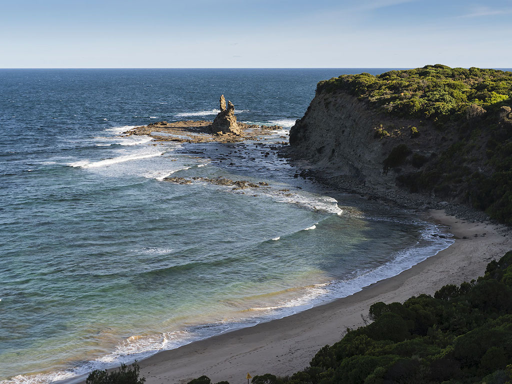
The beaches here have calm and tranquil waters with rocky outcrops at either end. On the western end of the beach there are some rock stacks called Bird Rock and Arch Rock.
Accommodation in the area consists of the Walkerville Foreshore Camping Reserve located in North Walkerville or Spindrift Cottage.
A hop, skip and a jump away from Walkerville is the quiet coastal town of Waratah Bay. Here there is a wide expanse of sandy beach that stretches as far as Sandy Point and the entrance to Wilsons Promontory. It is a beautiful spot for long beach walks, swimming and beach fishing.
The town does not offer much in the way of shops or eateries but there is the Waratah Bay Caravan Park with dog-friendly caravan and camping sites and a small store. Otherwise Sandy Point does have a general store and cafe.
Once we departed the Prom we headed east towards the town of Foster, a distance of 23 kilometres. This old gold mining town was settled in the 1870s, and is surrounded by rural countryside and vast farmlands.
Once called Stockyard Creek, you can explore the region’s mining heritage via walking tracks within the Foster Flora Reserve.
Being the main shopping precinct for Wilsons Promontory, you can pretty much find everything you need in Foster. The pretty main street is adorned with flower plantings, a cute clock tower and the historic Exchange Hotel. There are also a selection of bakeries and cafes for a quick bite to eat.
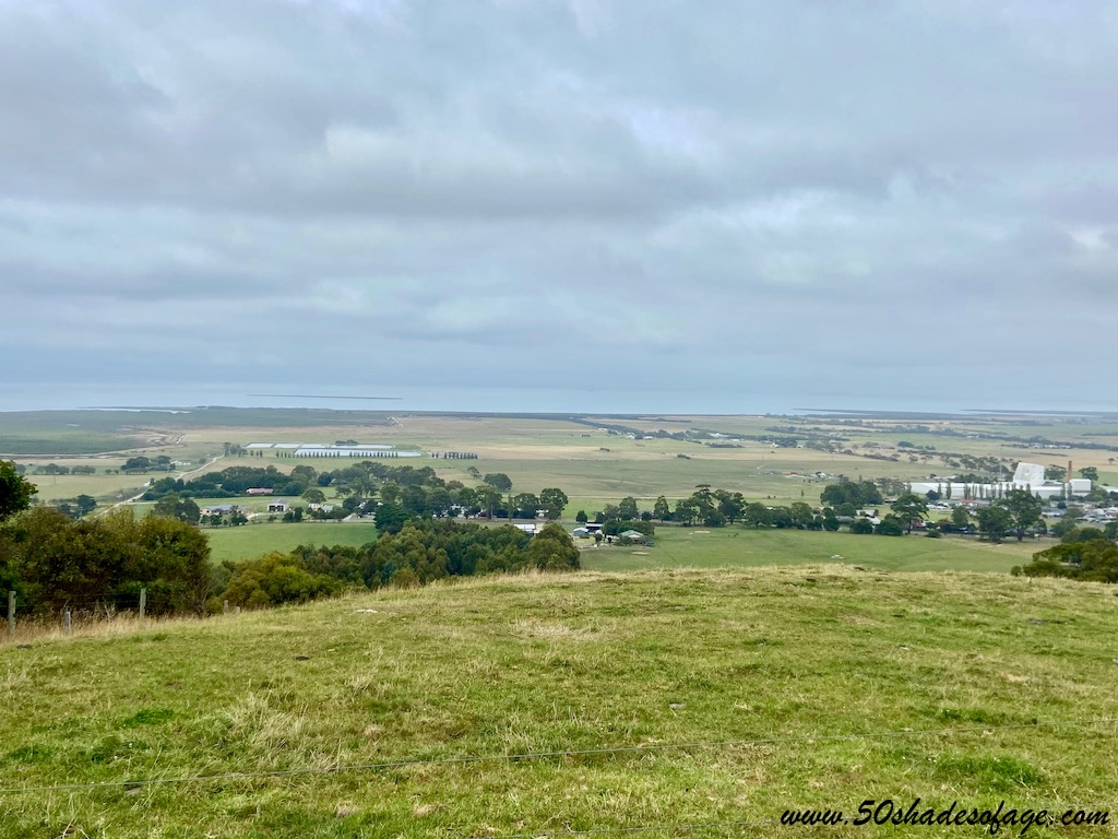
For some of the best panoramas around, stop at Foster North on the South Gippsland Highway, or Mt Nicholl Lookout, mid-way between Foster and Fish Creek. The views from both lookouts are spectacular and extend from the towering wind turbines at Toora, across Corner Inlet to the Prom, to the sand dunes at Shallow Inlet and the islands beyond.
Prom country simply took my breath away. I must admit it helped because we experienced amazing weather during our stay. We enjoyed crystal clear blue skies and sunshine each day, that made for perfect walking conditions and was a photographer’s dream.